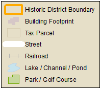
Click on the map within the Historic District to learn more about a property.
The "Highlight by..." tabs below can be used to highlight properties based on select attributes.
Note: Currently only one highlight query can be applied at a time. Queries do not combine or stack.
Highlight query tip: All queries are fuzzy in that entering "Colonial" in the Architectural Classification box highlights properties with colonial anywhere in the classification name. This means you will highlight many classifications such as Colonial Revival, Dutch Colonial Revival, Neo-Colonial, etc.
Address:
(e.g., 225 Greenwood, 1490 Chicago, 1810 Hinman)
Year Built:
or
Year Range: to
Architectural Classification:
(e.g., Colonial Revival, Queen Anne, Craftsman, Tudor Revival)
Architect:
(e.g., Mayo, Jennings, Tallmadge & Watson, Hunt)
National Register Landmark:
Local Landmark:
Local Historic District Contribution Status:
If you would like to...
Retrieve info about a property within the historic district: Single click on the property at any time
Move or Pan the map: Click and Drag
Zoom In: Click the "+" sign in the upper left of the map
Zoom Out: Click the "-" sign in the upper left of the map
Zoom In (another way): Double-Click
Zoom in to a specific region: Shift-Click and then drag a box
Zoom In (yet another way): Push forward on your mouse scroll wheel
Zoom Out (another way): Pull back on your mouse scroll wheel
Choose another basemap: Click "Basemaps" in the upper right of the map
Basemap tip: The bottom two choices are the Evanston specific basemaps. All the others are generic basemaps provided by ESRI.